 |
 |
 |
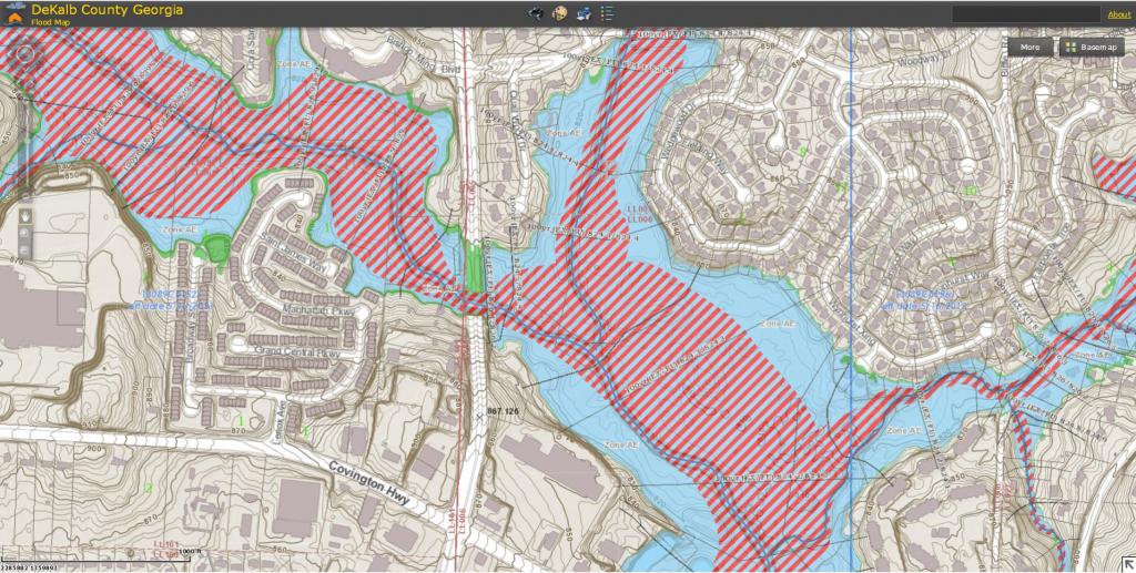
Flood Map
DeKalb County flood map shows flood risk zones and their boundaries. It also show floodways and Base Flood Elevations (BFEs) for all the studied areas. Users can enter an address or location and the map will show the flood hazard information for the specified address area.
The County’s flood map has the following features:
- Floodway (Striped Area): All encroachments into the County’s floodway are prohibited except for activities specifically allowed by the county's code ordinance such as, bridges, culverts, roadways and utilities and which shall comply with applicable floodplain regulations.
- The 100- year flood limit (light blue): Any development in this area must fully comply with the County floodplain regulations on encroachments.
- 500-year flood limit: Areas of lower risks but still regulated by the County
Click here to access DeKalb County’s Parcel Viewer with Flood layer.
Click here to access FEMA Map Service Center.
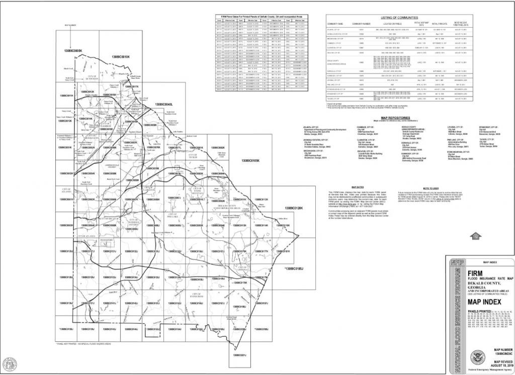
Flood Insurance Rate Map (FIRM)
This is the official map of a community on which Federal Emergency Management Agency (FEMA) has delineated both the Special Hazard Areas and the risk premium zones applicable to the community. A property owner can use a FIRM to know the flood zone in which the property is located.
Generally, a FIRM will show the following;
Roads and map land marks,
-
A community’s base flood elevations
-
Flood zones and
-
Floodplain boundaries
Follow this link to check the Flood Insurance Rate Map for your property
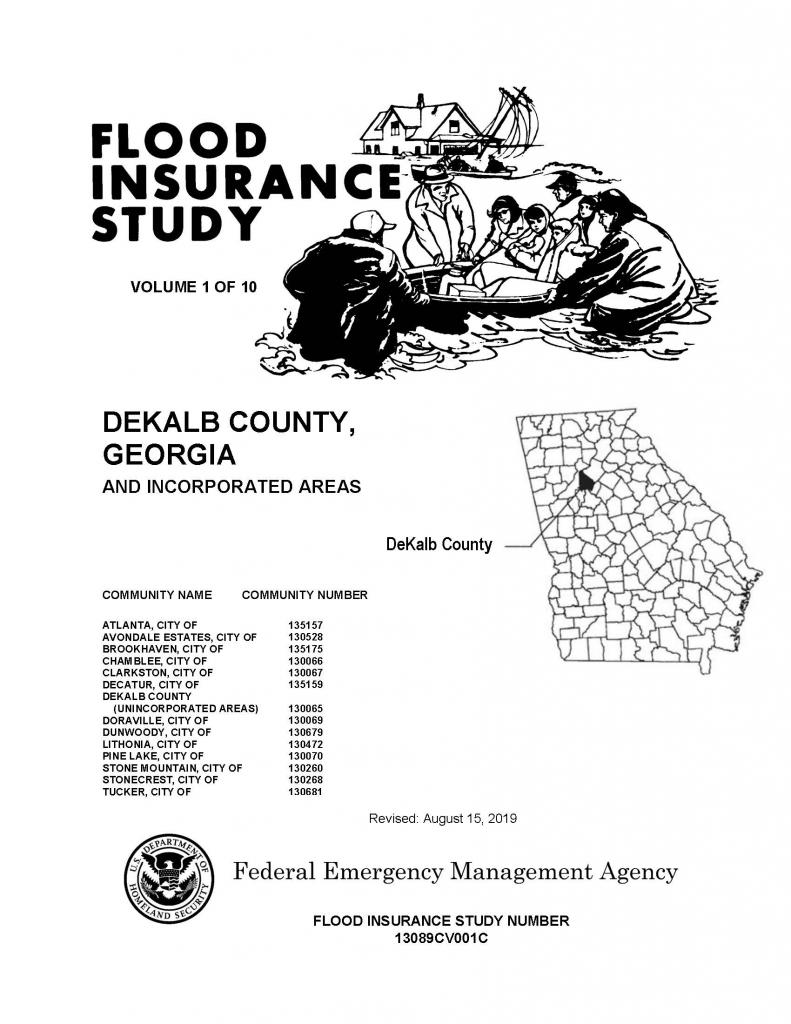
Flood Insurance Study (FIS)
This is a compilation of the flood risk data for specific watercourses, lakes and coastal flood hazard areas within a community. The flood study is usually completed for NFIP, and the information and maps presented in the report. The report usually contains detailed flood elevation data in flood profiles and data tables.
Follow these links to the Effective Flood Insurance Study
volume 1 of 10
volume 2 of 10
volume 3 of 10
volume 4 of 10
volume 5 of 10
volume 6 of 10
volume 7 of 10
volume 8 of 10
volume 9 of 10
volume 10 of 10
Contact the Floodplain management office at 404-297-4518 for historical Maps, FIRMs and FIS.