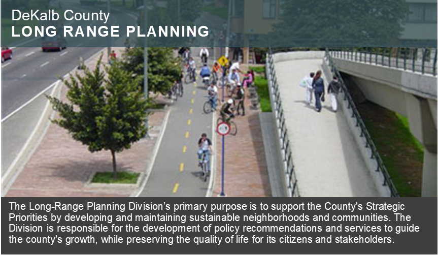

| Mission Statement |
To advance a long range vision of a livable, equitable, sustainable, beautiful, and prosperous DeKalb County through the implementation of adopted plans, policies, and partnerships. |
| Comprehensive Planning |
 | 2050 Unified Plan Summary |
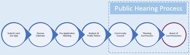
LAND USE AMENDMENT PROCESS
Because of the intense public vetting process of the comprehensive plan, it is encouraged that no changes be made to the Future Development Map. However, there are certain criteria that may apply when proposing a land use amendment: | |
| ARCHIVED PLAN DOCUMENTS 1964 DeKalb County Comprehensive Plan 1995-2015 DeKalb County Comprehensive Plan 2005-2025 DeKalb County Comprehensive Plan 2035 DeKalb County Comprehensive Plan (5-year Update) | ARCHIVED LAND USE MAPS 1962 Existing Land Use Maps 1964 Land Use Map 1977 Comprehensive Land Use Map 1986 Comprehensive Land Use Map |
| Transportation Planning |
2050 Transportation Plan
Transit Oriented Development |
| |
Useful Transportation Links |
| Small Area Plans (SAP) and Studies |

| Sustainability |
 | Visit the recently revitalized Sustainability Webpage and explore the different sustainability initiatives around DeKalb County. | Quickly jump and look at our different sustainability initiatives below: |
| Planning Education and Participation |
 | Engage DeKalb - Community Feedback Platform DeKalb County Neighborhood Registry Zoning 101 Presentation DeKalb Community Academy (Ongoing!) |
| Demographic Research and Reports |
 | DASHBOARDS & PROFILES *NEW* DeKalb County Key Information Demographic Dashboard – Atlanta Regional Commission Neighborhood Nexus Fact Sheet Interactive Profile for DeKalb County (US Census Bureau) DEKALB BY THE NUMBERS – 2022 (ACS 5-Year) (Source: ESRI Community Analyst) Population – 762,820 White – 30% Black – 52.4% Hispanic – 8.6% Asian – 6.1% Other – 4.2% Two or More – 6.6% Median Household Income - $76,044 Unemployment Rate – 4.5% Mean Travel Time to Work – 31.3 minutes Owner Occupied Housing – 57.85% | ||||
New! Commission District Profiles (2025)
| Commission District Profiles Story Maps (2022)
| Annual Development Recent Major Developments in DeKalb (2022-2023)
| Additional Resources |
| Service Delivery Strategy (SDS) Intergovernmental Coordination |
 | Full 2019 SDS Document SDS 2019 Matrix Service Area Maps Quick Links GA Department of Community Affairs City of Atlanta City of Avondale Estates City of Brookhaven City of Chamblee City of Clarkston City of Decatur City of Doraville City of Dunwoody City of Lithonia City of Pine Lake City of Stone Mountain City of Stonecrest | |
| In accordance to the State of Georgia’s Service Delivery Strategy law, local governments are encouraged to keep their SDS accurate and up to date. The purpose of the SDS is to provide an action plan for the County, supported by ordinances and intergovernmental agreements, to resolve land use conflicts. Counties and their municipalities are required to periodically amend/revise the existing SDS so it will always be current and reflect the locally preferred delivery. | ||
| NEWSLETTER ARCHIVE |
Sign up for our mailing list here!
Long Range Planning (2023) | Long Range Planning (2024) | Long Range Planning (2025)
|
Planning Services (2025) | Planning Services (2026)
|
| ADDITIONAL RESOURCES |